
BAHCHISARAI. KORDON LESNIKOVO


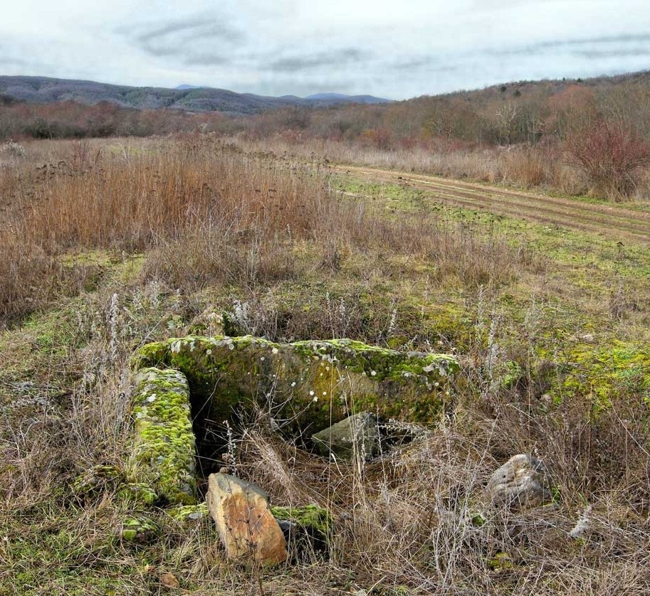
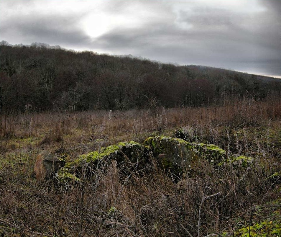
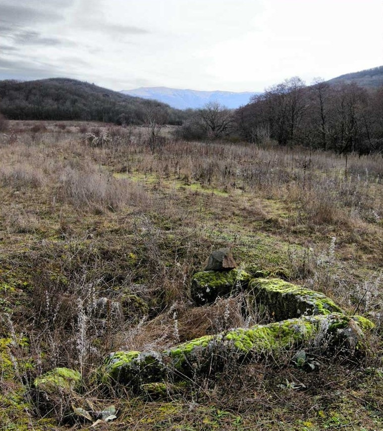
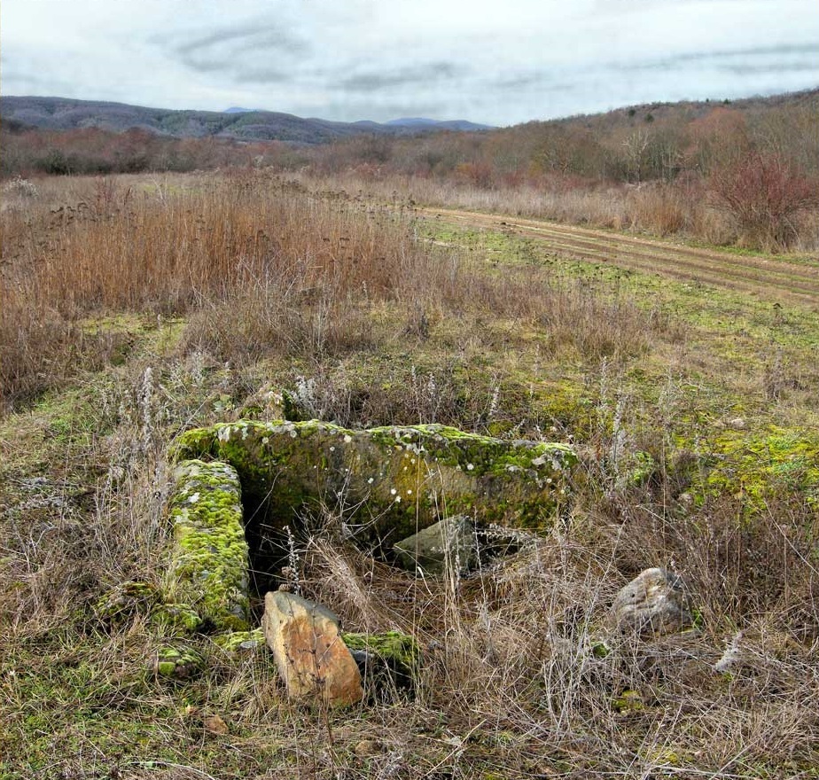
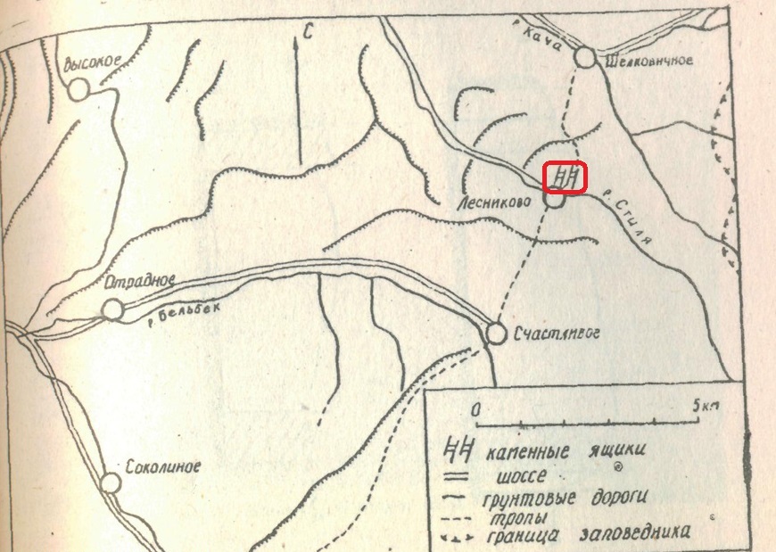
The cordon Lesnikovo (Bakhchisarai district) has only two dolmens, only one of which has two plates. It is composed of thick massive limestone slabs and has dimensions of 2.5x2 m. Vertical grooves about 2 cm deep are made on the inner walls of the longitudinal slabs. Transverse slabs were inserted into these grooves. The narrowing of the grooves from 18 cm in the upper part to 17 cm in the lower part ensured jamming of the inserted plate and thereby added strength to the structure. The height was initially somewhat larger, but when plowing the territory, its upper part was damaged and it became slightly lower.
Scientists date the local dolmens 5-6 centuries BC and find them very similar in design to the dolmens of the Baydar Valley.
From the first dolmen, only two longitudinal plates standing upright were preserved in their original place (length - 2 m, thickness - 0.2-0.35 m, height above the level of the modern surface - 0.8 m).
One of the transverse plates (dimensions 1.4X1.35X0.3 m) was located 10 m west of the dolmen.
The second dolmen was located at a distance of 50 m east of the first. There was no coverage. Four slabs mounted vertically rose slightly above the level of the modern surface. The length of the longitudinal plates is 2.15 and 2.55 m, the transverse ones are 1.4 and 1.5 m, and the thickness is 0.2-0.3 m.
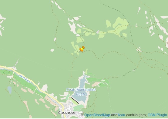
In connection with the liquidation p. Lesnikovo, caught in the sanitary zone under construction on the river. Kache Zagorsk reservoir, and plowing of its territory, dolmens were significantly affected. When examining the plowed area on the eastern outskirts of the village, 15 m south-west of the surviving school building, near the dirt road (south of it), we noticed large plates of partially destroyed dolmen, slightly protruding above the ground. The first dolmen is destroyed and, possibly, scented during leveling.
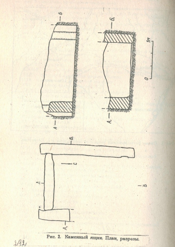
Excavations of the dolmen in 1954 by Researcher E.V. Weimarn showed that it was arranged as follows. Dolmen walls were dug into the continental gravelly-pebble layer, possibly into the already prepared pit. Its bottom is slightly inclined to the northwest. The rectangular-shaped dolmen is constructed of four massive processed plates of local light gray sandstone, well fitted to each other. Dimensions 2.55X1.97 m, inside the walls 1.8X1.5 m. The upper part of the rectangular slabs, preserved to a height of 0.8 m, was destroyed when plowed. At that time, the transverse northern and most of the longitudinal eastern plates were demolished. With its long axis, the dolmen is oriented from north to south. Cross plates were concluded between the longitudinal ones, which continued 0.15 m further than the joints with the transverse southern plate. The end of the southern slab extends into a vertical rectangular groove 0.23 m wide and 0.03 m deep, knocked out in a longitudinal western slab. A similar groove is present at the opposite end of this plate, 0.2 m from the crane.
It tapers slightly to the bottom. Its width in the upper part of the slab is 0.18 m, in the lower part it is 0.17 m, and the depth is 0.02 m. The narrowing of the groove provided jamming of the slabs and the structural strength of the entire structure.
Coordinates:44°35'57.9"N 34°04'33.3"E